FISHWATCH 2021 MONTHLY REPORT AUGUST 2021
by Edward Kikumoto
Again this year, the U.S. Forest Service and The North Umpqua Foundation (TNUF) is asking the public not to visit the Big Bend Pool (the Pool) due to Covid19 concerns, and to protect the health of the FishWatch Caretaker.
The opinions in this report are strictly my own, and do not reflect the views and opinions of the U.S. Forest Service, the Oregon Department of Fish & Wildlife, or The North Umpqua Foundation.
Greetings from the Big Bend Pool FishWatch 2021 Caretaker,
Again, this month, fires in the Steamboat Creek Basin (Basin) have kept FishWatch away from the Big Bend Pool.
And I have no current information about the status and wellbeing of the steelhead currently in the Pool.
What I will be reporting on, in this report, is the fire situation in the Basin, and current environmental conditions in the Umpqua National Forest, and the North Umpqua River watershed.
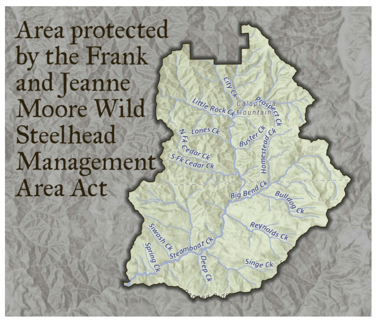
Keep in mind that the Basin is also designated as the Frank and Jeanne Moore Wild Steelhead Special Management Area, which is intended to be a thermal refuge for steelhead. (See BBP FIELDNOTES, below.)
Big Bend Pool
Access –
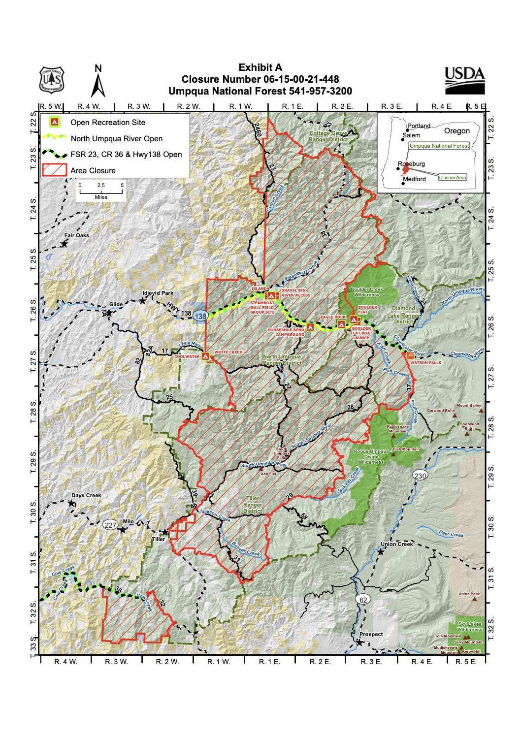
On August 10, the US Forest Service informed us that no one other than firefighters were allowed into Steamboat Creek Basin.
Fish count –
The last report of the number of steelhead in the Big Bend Pool is from about July 21st. The Oregon Department of Fish & Wildlife (ODFW) observed 55 steelhead in the Pool. In comparison, in 2018, ODFW estimated 170 steelhead in the Pool in mid-July.
The low fish count is troubling.
Infrastructure
The Airstream was removed from the Big Bend Pool on July 9.
The 250-gallon propane tank was removed from the Big Bend Pool around August 17. As of August 20 the portable toilets were still at the Pool.
The Airstream is on its covered pad at the Sawtooth Garage on the Steamboat USFS/ODOT compound, and is checked regularly.
The four 6-volt golf cart batteries have been removed, and are in my garage on a trickle charger.
Jack Fire and Rough Patch Complex Fires
The Jack Fire started on July 5, about 2-miles east of Steamboat on the North Umpqua Highway (Hwy 138).
In the late afternoon of July 5, it was approximately 60 acres on a steep slope above Hwy 138 and was spreading both back (west) and up (east) Hwy 138.
By mid-July the fire had moved within 1-mile of Steamboat on the north side of Hwy 138, and moved upslope to the ridgeline (Ragged Ridge) overlooking Steamboat Creek Basin.
The fire pretty much stopped there – its western flank, closest to Steamboat.
The prevailing winds being from the northwest pushed the fire rapidly east, up Hwy 138 to Dry Creek, which is 8-miles east on Hwy 138, has continued to spread in a southeasterly direction, and has merged with the Buckhead and Near Minky Fires.
As of September 7, the three fires total 34,441 acres. (See the fire maps, below.)
The Rough Patch Complex Fires (Chaos, Little Bend Creek, Buckhead, and Near Minky).
The Buckhead and Near Minky fires are south of the Jack Fire.
The Chaos Fire and Little Bend Creek Fire are in Steamboat Creek Basin.
These fires are the result of lightning strikes from July 30 to August 1st, which resulted in 42 identified fires.
On September 5, the fires covered 40,126 acres and were 28% contained.
The Chaos Fire as of September 5, is reported to be 22,090 acres, and the Little Bend Creek Fire is 7,585 acres – total 29,675 acres, and continuing to grow.
By the end of August the Chaos Fire and Little Bend Creek Fire had merged along Steamboat Creek Road (Forest Service Road 38). (See fire maps, below, and the maps on the Inciweb Rough Patch Complex Fire – link, below.)
As you will see from the fire maps, the Little Bend Creek Fire’s southwest corner is at the intersection of Steamboat Creek Road (FSR 38) and Homestead Creek Road (FSR 3818).
It appears that the fire stops at Big Bend Creek Bridge, and is contained at that point. And it hasn’t crossed over Steamboat Creek Road to Steamboat Creek except for one spot about 1.5 miles upstream before Cedar Creek (2 miles upstream) where the Chaos Fire merges with the Little Bend Creek Fire.
The bridge and intersection are within 100-yards of the Big Bend Pool.
And where the fire has crossed Big Bend Creek – up a ways on Homestead Creek Road – it is approximately 500-yards from the Pool, and moving towards Reynolds Ridge on the south side of Steamboat Creek Road – burning away from Steamboat Creek. (See fire maps, below.)
Also of particular concern is that most of the Chaos and Little Bend Creek Fires are within Steamboat Creek Basin, which is now The Frank and Jeanne Moore Wild Steelhead Special Management Area (Sanctuary).
The Sanctuary is approximately 100,000 acres, designated a thermal sanctuary, and is prime wild summer steelhead spawning habitat.
One can only wonder what the long-term impact the fires will have on the water temperatures and habitat in the Steamboat Creek Basin, and the survival of the North Umpqua River’s wild summer steelhead.
The Jack Fire was the initial reason that Steamboat Creek Basin was closed, and the reason for pulling the Airstream out of the Basin.
The fires in Steamboat Creek Basin are why we have not been able to return to the Big Bend Pool.
Fire Maps (See end of report.)
- Jack & Rough Patch Complex Fires and Closure Boundaries Map 09.07.21
- Steamboat Creek Basin Map 09.06.21
- Little Bend Creek Fire Map 09.06.21 CloseUp
The ARROW in the Little Bend Creek Fire Map CloseUp points to the Big Bend Pool, and will give you an idea of how close the fire is to the Pool.
Further Restrictions Due To Fire Danger, Drought, And Low Steelhead Return Counts
North Umpqua River Fishing Closure Order, ODFW 08.09.21
North Umpqua River, tributaries, closed to all angling
Tweet August 9, 2021
ROSEBURG, Ore – Low numbers of summer steelhead returning to the North Umpqua River prompted state fishery managers to close the river and its tributaries to all angling from the mouth to the marker below Soda Springs Dam. The emergency closure is effective Aug. 10 through Nov. 30, 2021.
Initial counts of summer steelhead passing Winchester Dam are historically low at about 20 percent of average. These counts are determined from Winchester Dam video of migrating fish as well as from snorkel counts in Steamboat and Canton Creeks.
“This information, along with the continued low flow and high water temperatures, led us to this decision. We plan to have this closure in place through November to provide as much protection as possibly for these wild summer steelhead,” said Evan Leonetti, assistant district fisheries biologist.
Greg Huchko, Umpqua district fish biologist said the decision was not easy to make and he hopes anglers will understand the need for the closure during these unprecedented decisions.
Umpqua National Forest Emergency Fire Closure Order, 08.13.21
(The link to the order in its entirety is below.)

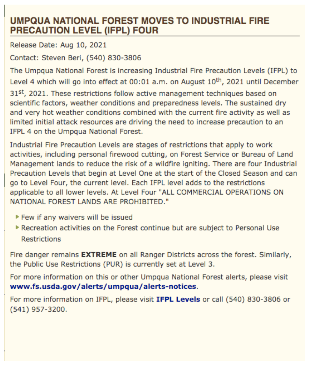
Umpqua National Forest Industrial Fire Precaution Level (IFPL) 4, 08.10.21

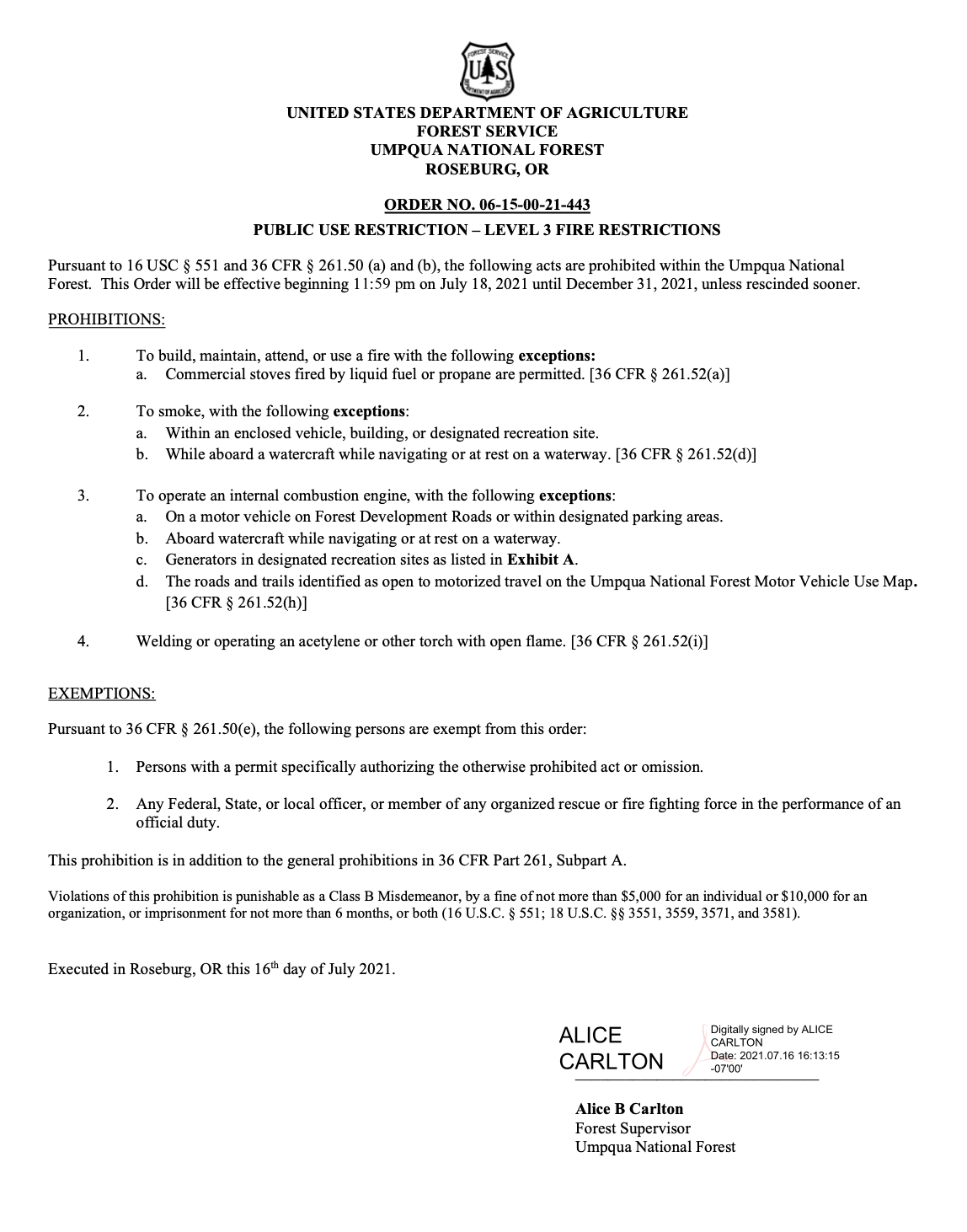
Umpqua National Forest Public Use Restrictions Level 3, 07.16.21

Links
Inciweb – Rough Patch Complex Fire Maps https://inciweb.nwcg.gov/incident/7758/
Umpqua National Forest Emergency Fire Closure Order & Maps 08.13.21 https://www.fs.usda.gov/Internet/FSE_DOCUMENTS/fseprd940195.pdf
BBP FIELDNOTES
Steamboat Creek Basin: The Frank and Jeanne Moore Wild Steelhead Special Management Area


